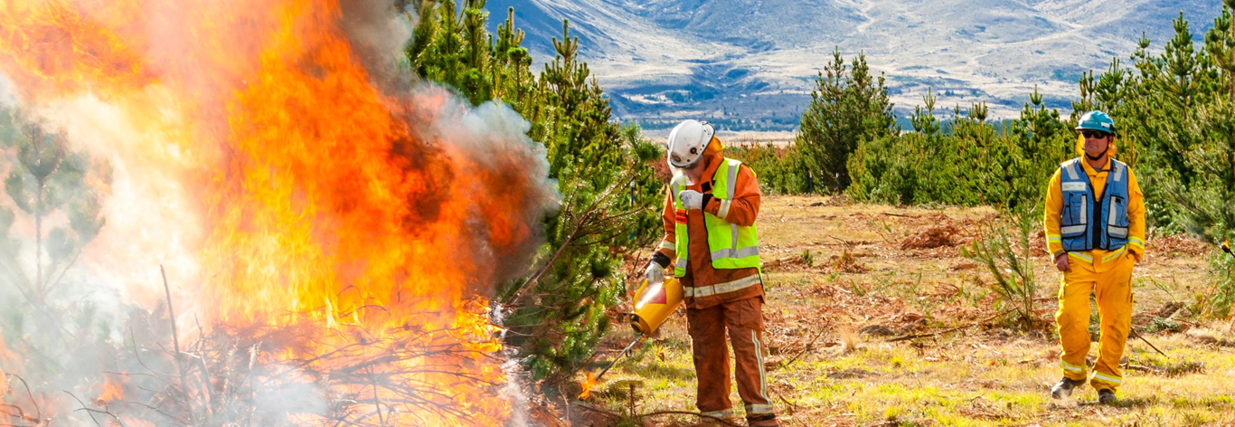
Before a wildfire even begins, the ground might already be giving off warning signs. Science communicator Ceana Priest catches up with wildfire scientist Grant Pearce to dig into the science of soil moisture and how it’s helping us better predict, prepare for, and respond to wildfires across Aotearoa. From high-tech soil sensors to the fiery edges of the wildland-urban interface, it’s a story about understanding the land beneath our feet—and the fire risks that come with it.
Background and training
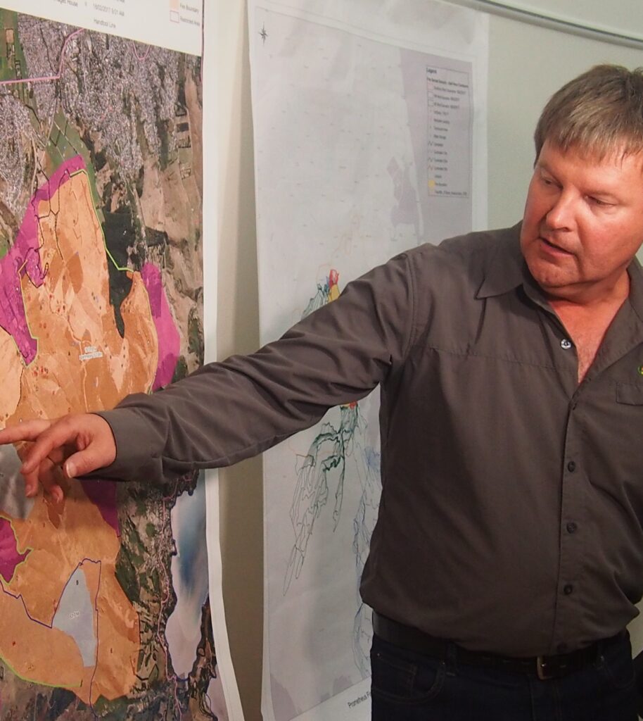
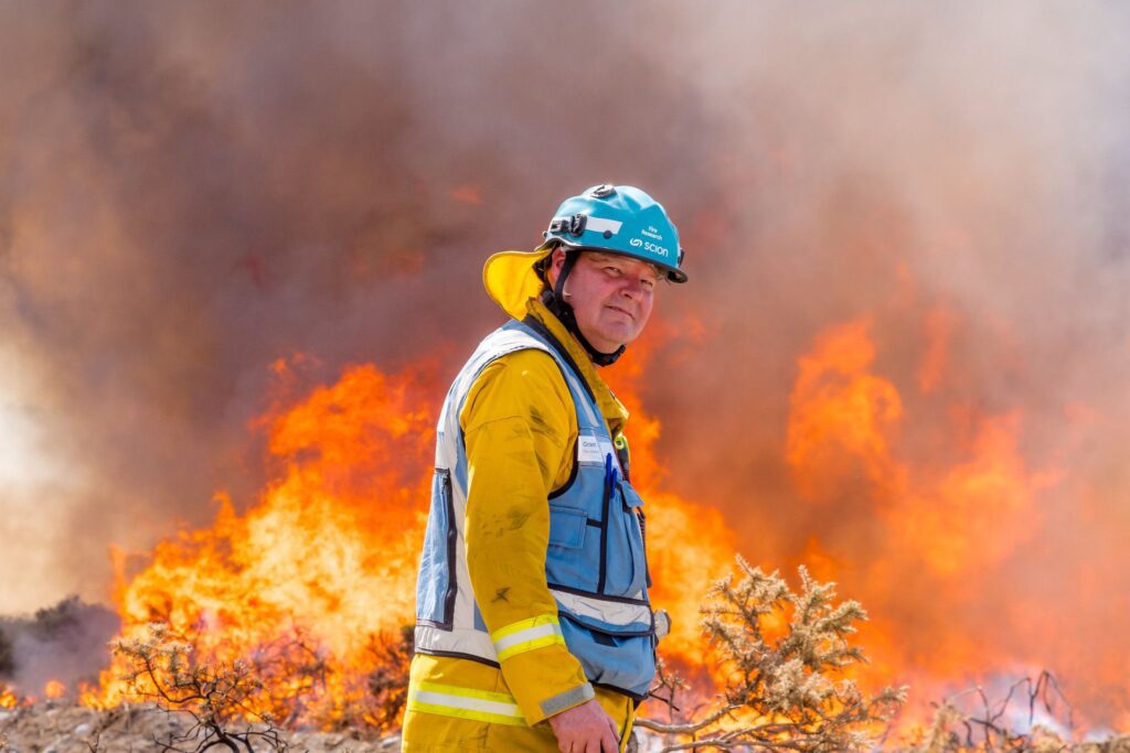
Grant is a wildfire scientist with Fire and Emergency New Zealand, based in Christchurch, and is recognised as one of the country’s leading experts on how wildfires behave. His passion for geography began in childhood, shaped by time spent tramping in the mountains with his father. After attending Ashburton College, Grant went on to study physical geography at the University of Otago, earning both a BSc and an MSc. While fire science wasn’t his original plan, a role with Scion’s rural fire research team after graduating sparked a long-standing interest. He ended up staying with the team for nearly 30 years before moving to Fire and Emergency New Zealand.
Over the years, Grant has focused on how weather affects wildfires—how fast they spread, how far they travel, and how we can better predict the risks. He played a key role in developing New Zealand’s Fire Danger Rating System, which helps keep the public up to date with daily fire risk information. Grant enjoys the variety that comes with his work—whether he’s out in the field, running lab experiments, training others in fire behaviour, or collaborating with scientists and firefighters. He’s passionate about using science to protect people and frontline crews and often shares his expertise during major fire events both in New Zealand and overseas.
Grant encourages future scientists to stay curious and engaged with the world around them. “Just be inquisitive,” he says. “Observe nature and develop a passion for trying to understand what’s happening—what you’re seeing.” He believes science often starts with simple questions and a desire to understand how things work. He also reminds young people to keep an open mind about their career paths. “Just because you haven’t heard of a job doesn’t mean it doesn’t exist—or won’t in the future.”
Understanding soil moisture and fire risk
In 2021, Grant teamed up with Laureline Rossignaud and Samuel Aguilar-Arguello to publish a research paper examining soil moisture and temperature patterns across New Zealand. They used data from around 140 weather stations, where sensors buried 10 cm deep recorded soil moisture (as a percentage) and ground temperature. The data from each station is fed into the nationwide Fire Weather System (FWSYS), developed by scientists at NIWA and Scion, which helps improve fire danger predictions nationwide.
Their research investigated how the data could enhance current fire danger assessments, particularly by understanding the dryness of deeper soil layers and key grassland fire conditions, such as the dryness of the grass, the amount of fuel present, and the extent of fuel.
Why does soil moisture matter?
Soil moisture is crucial because it significantly impacts how plants grow and die, contributing to the creation of fuel for fires.
- Grass curing: When the soil is dry (low soil moisture), plants can get stressed. This causes the water inside them to decrease, or they may even die and turn into dry, dead material. This dry, dead material is called cured grass, and it’s much easier to ignite and burn. Grasses can also naturally cure following a biological process of flowering/seeding, either as an annual or seasonal cycle.
- Grass fuel moisture: When the soil is wet (increased soil moisture), it helps plants grow. The amount of water in living grass is mainly controlled by the plant itself and the time of year. More plant growth means there is more fuel (grass) available to burn if conditions become dry later. Soil moisture also affects how quickly other fuels, like the layers of dead leaves and organic matter (called duff) on the forest floor, dry out. Research suggests that soil moisture data could help improve predictions of grass curing and fuel dryness. This can lead to more intense fires. Soil moisture data could potentially help predict the overall moisture content of grass fuels.
- Grass fuel load: How much available grass to burn (fuel load) is mainly determined by how much the grass grows. Soil moisture and temperature are essential factors for grass growth, along with sunlight and nutrients. Soil moisture data can be used in models that predict how much grass is growing and how much fuel is accumulating.
Measuring soil moisture
Grant’s research relied on soil moisture probes that use time domain reflectometry (TDR), which is similar to shouting into a tunnel and timing the echo. Instead of sound, it sends a super-fast electrical pulse through metal rods into the soil and measures how long it takes for the pulse to bounce back. Water slows down that pulse—the wetter the soil, the slower the pulse travels. By timing this delay down to picoseconds (trillionths of a second), the sensor calculates permittivity, a score that reveals the amount of water in the soil. From that, it works out the Volumetric Water Content—the percentage of the soil’s volume filled with water. On top of that, it measures Bulk Electrical Conductivity (which tells us about salts and ions in the soil) and soil temperature. So, without digging anything up, this sensor provides a detailed snapshot of soil moisture, salinity, and temperature simply by timing a pulse.
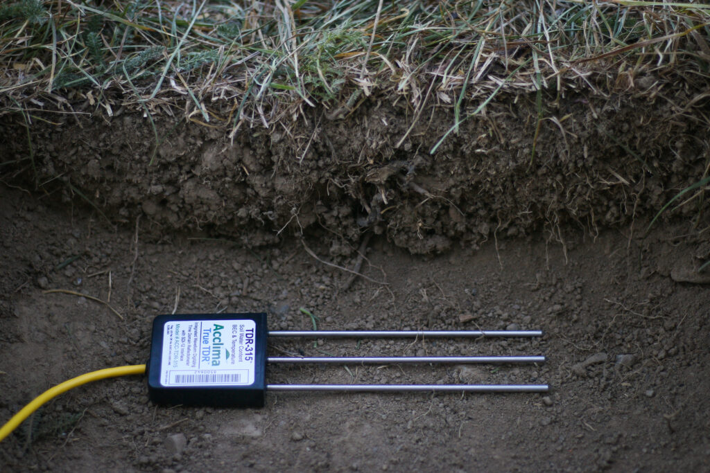
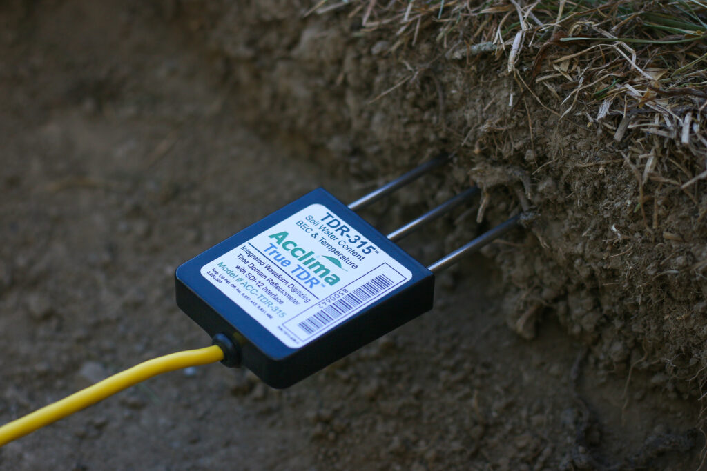
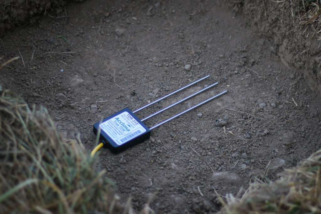
Soil moisture in the root zone is especially important for tracking grassland fire risk in New Zealand, says Grant. By using the probe at 10 cm, it aligns with the root zone is where many grass species draw water, and also with fire risk indicators like the Drought Code—a component from the NZ fire danger rating system that indicates the dryness of deep soil layers and therefore potential for drought conditions. New Zealand’s fire danger rating system was originally developed to monitor soil dryness in forested areas, but researchers are now applying it to grasslands, which are a major fuel type across the country. As grasses go through their natural life cycle—greening up in spring and drying out in summer—monitoring root zone soil moisture provides an early warning of when they’re likely to brown off (’cure’) and become flammable. This helps indicate when grasslands are transitioning into dry fuel, improving fire preparedness.
Why does grass burn?
Dry grass alone doesn’t start fires—it needs an ignition source. In New Zealand, around 98% of wildfires are caused by humans, either directly or indirectly, while only 1–2% result from natural causes such as lightning or spontaneous combustion. Grasses are generally more flammable than herbaceous plants but less flammable than trees.
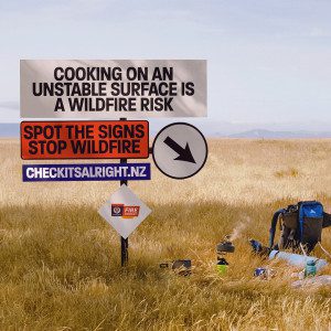
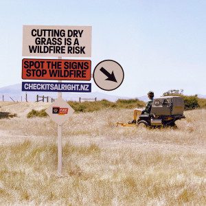
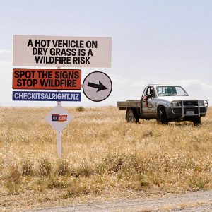
Human-caused wildfires can be grouped into three main categories:
- Intentional: Deliberate arson.
- Accidental: Land clearing burns that go out of control, discarded cigarettes, hot vehicles, unattended campfires, fireworks, sparks from agricultural machinery and equipment malfunctions.
- Negligence: Leaving fires unattended, failing to properly extinguish them, or not taking precautions during dry conditions.
To help manage fire risk, Fire and Emergency New Zealand sets fire seasons that determine when fires can be lit: open season means no permit is needed; restricted season requires a permit with specific conditions; and prohibited season is a total fire ban, where no open-air fires are allowed under any circumstances.
So, what’s inside grass that makes it burn?
Grass contains a mix of natural chemicals that help it catch fire easily:
- Cellulose – the main building block of plant cells. It’s a carbohydrate, made up of carbon, hydrogen and oxygen atoms, and like paper or wood, it burns well when dry.
- Lignin – another structural part of plant walls, lignin burns slower than cellulose but gives off more heat.
- Waxes – grass leaves are coated with a thin waxy layer to keep moisture in while growing. But once dry, this wax acts like a fire starter, helping flames spread quickly.
- Silica – this gritty mineral builds up in the leaves of many New Zealand pasture grasses. While silica itself doesn’t burn, it makes leaves rough and stiff—traits that help them stay upright and dry out quickly, but which also increases their flammability.
- Oils and terpenes – found in some native tussocks and introduced pasture species. These volatile compounds vaporise easily and can help fires start and spread fast.
Predicting fire in New Zealand
Fire and Emergency New Zealand and other fire and land managers such as Department of Conservation, forestry managers and New Zealand Defence Force use the New Zealand Fire Danger Rating System (NZFDRS) to monitor fire danger and inform fire management decisions. As fire danger levels increase, so do the readiness levels within a district or region, says Grant. This means the response plan may change—for example, instead of sending just one or two fire trucks to an incident, more resources might be deployed. Crews may also be placed on shorter standby times so they can respond faster. In some cases, heavier equipment like helicopters will be put on standby, ready to assist as soon as needed.
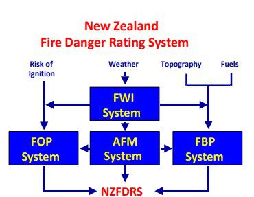
The NZFDRS uses several subsystems to determine fire danger classes and other outputs that help inform these decisions, including:
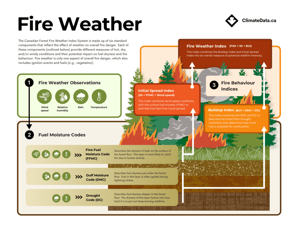
- Fire Weather Index (FWI) System: This is the core system, which uses weather data like wind speed, temperature, humidity, and rainfall to assess fire danger. It provides numerical ratings of the relative fire potential (ease of ignition, fire spread and difficulty of control) in a standard fuel type (i.e., a mature pine stand) on level terrain, based solely on weather observations measured daily at noon.
- Fire Behaviour Prediction (FBP) System: This system provides quantitative fire behaviour estimates (fire spread rates, fuel consumption and intensity) for different fuel types and topographic situations based on FWI and fire weather observations at the time of the prediction.
- Accessory Fuel Moisture (AFM) and Fire Occurrence Prediction (FOP) systems: These subsystems aid prediction of fuel moisture and associated likelihood of ignition in different fuel types from various fire causes.
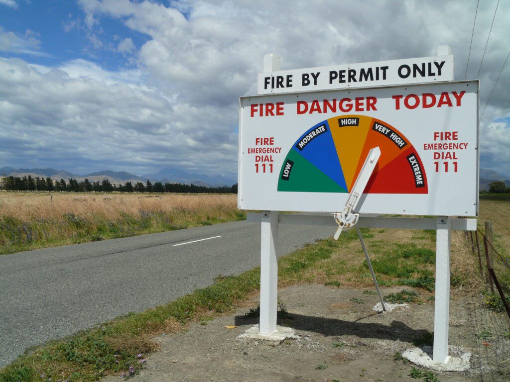
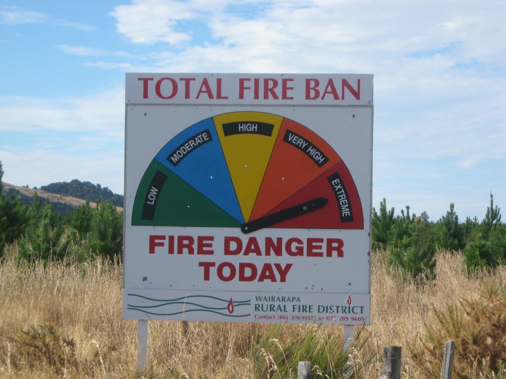
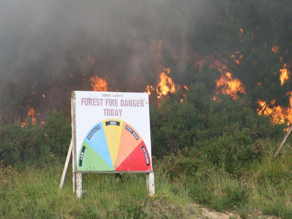
Information from all the above systems means fire danger can be classified into five levels—you’ll have probably seen the roadside signs (above):
- Low: Minimal fire danger.
- Moderate: Some fire danger, with moderate fire spread and intensity.
- High: Increased fire danger, with potential for larger fires and more difficulty in suppression.
- Very High: Significant fire danger, with a high risk of large wildfire outbreaks.
- Extreme: Very high fire danger, with a very high risk of large wildfires and potential for widespread damage.
Fire Weather Index System
This sub-system is a key part of the New Zealand Fire Danger Rating System (NZFDRS). Originally developed in Canada, it includes fuel moisture codes, which track how wet or dry different types of vegetation (or ‘fuels’) are. By measuring the moisture content in forest litter and soil organic layers, it helps fire managers build a clearer picture of overall fire risk across the landscape.
The Fine Fuel Moisture Code (FFMC) is a numerical rating of the moisture content of forest litter (leaves, pine needles and small twigs on the ground) and other cured fuels (such as grasses and scrub). This code is an indicator of the relative ease of ignition and flammability of these fine fuels, with high FFMC values meaning fires will ignite easily and spread rapidly, especially with wind.
The Duff Moisture Code (DMC) is a number used to show how wet or dry the layer of rotting leaves and organic stuff—called duff—is under the forest floor. This spongy layer sits just below the top layer of fallen twigs and leaves. When it’s too dry, it can smoulder for days or even weeks, making fires much harder to put out. Fire crews and land managers use the DMC to understand how likely it is that a fire could burn down into this layer and keep going. A high DMC means the duff is dry, and fires are more likely to burn deeper and do more damage. Because duff takes a while to dry out (much slower than dry grass or leaves on the surface), the DMC includes a built-in delay, or ‘time lag,’ of about 15 days. That means it reflects longer-term drying, not just one hot afternoon. A DMC over 20 suggests that a lightning strike might start a fire, and over 40 means there’s a strong chance of deeper, more damaging burns.
The Drought Code (DC) is a numerical rating of the average moisture content of deep, compact, organic layers. This code is a useful indicator of seasonal drought effects on forest fuels, and the amount of smoldering in these deep duff layers and large logs.
Natural hazards meet urban environments
Fire is becoming an increasingly severe natural hazard in New Zealand, with a growing impact on property, especially in areas where houses and vegetation meet, known as the rural-urban interface. Significant events, such as the Port Hills fires, have highlighted the vulnerability of communities built near flammable landscapes. International research has long focused on this zone, called the wildland-urban interface, in places like California and Mediterranean Europe, where the risk of wildfires spreading to homes is high. “New Zealand is not immune from that; we’re also seeing an increasing threat of fires in those areas,” says Grant. “That’s where people are; that’s where property assets are – so that’s where fires are most likely to start and do the most damage. It’s about understanding what we can do to mitigate that risk, in terms of using lower flammability species, or building houses differently, or designing our gardens and subdivisions differently so that fires don’t spread as easily.”
But, he says that efforts to adapt to other natural hazards, such as moving homes away from tsunamis or coastal inundation zones, can unintentionally increase exposure to fire risk, especially when people relocate to steep, vegetated slopes. “We might move people away from one hazard. But are we putting them in greater danger from another? Balancing our responses to these different risks is essential for safer long-term planning.”
Conclusions
Grant’s research showed just how valuable soil moisture data can be and backed the continued rollout of sensors at more weather stations nationwide. However, because of the wide range of grass species and methods used, existing models from overseas for estimating things like grass curing, moisture levels, and fuel loads can’t be directly applied to New Zealand conditions. Grant recommends determining the most effective ways to utilise this data to enhance fire danger ratings and improve grassland fire predictions. This includes figuring out the best depth to measure soil moisture, understanding how different soil types affect the measurements and relationships, and potentially combining weather station data with other sources like satellite information or computer models.
Ngā kupu
ahi – fire
kōngotungotu – firebrand, burning stick, piece of burning or glowing wood.
maroke – be dry, arid
ngahere – bush, forest
pāka – to burn, be scorched
tipitipi ana – spread rapidly, spread like wildfire
whakawera – to heat
Classroom activity
Fire Safety Squad: Danger Detectives!
Here’s a fun and educational Fire Safety Squad Activity Sheet idea for kids, designed to help them understand how fire danger is predicted and the role soil moisture plays.
Classroom resources
Science Learning Hub | Investigating moisture content
VIDEO: Create a soil moisture sensor
Links
Fire and Emergency New Zealand | How to stay safe
Science Learning Hub | Low-flammability garden saves home
Fire and Emergency New Zealand | View list of low-flammability species
References
We wish to thank ClimateData.ca for providing the fire weather graphic used in this article. ClimateData.ca was created through a collaboration between the Pacific Climate Impacts Consortium (PCIC), Ouranos Inc., the Prairie Climate Centre (PCC), Environment and Climate Change Canada (ECCC) Centre de Recherche Informatique de Montréal (CRIM) and Habitat7.
For more information, visit: https://climatedata.ca/

